Day trips are sometimes included, that means we did not drag Tana around, just drove Jolly.
Map 1, Starting about 100 miles from our home in SE Michigan at Auburn Indiana, to the beginning of the Natchez Trace, just southwest of Nashville Tennesee. This map represents 445 miles.

Map 2, The Natchez Trace, about 470 miles. The Trace itself is 444 miles, we actually drove 434 of it, skipping the last 10 miles. We drove on the Trace for 4 days.

Map 3, Natchez Mississippi to New Orleans, Louisiana. About 190 miles.

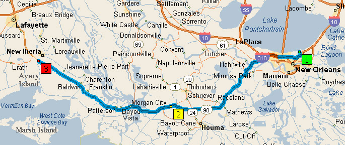
Map 4, New Orleans Louisiana to New Iberia Louisiana, about 138 miles.
Map 5, New Iberia Louisiana to near Beaumont Texas, 160 miles.

Map 6, Beaumont Texas to Jamaica Beach (near Galveston) Texas. Less than 90 miles, includes a free ferry ride from Port Bolivar to Galveston!


Map 7, Jamaica Beach Texas to Stonewall (near Fredericksburg) Texas, 285 miles. Yep, right through downtown Houston!

Map 8, Stonewall Texas to Fort Stockton Texas, about 275 miles.

Map 9, Fort Stockton Texas to Stillwell Store and RV Ranch Campground, about 100 miles.

Map 10, Stillwell Store and RV Ranch Campground to Study Butte, Texas, about 60 miles.

Map 11, Study Butte Texas to Fort Davis Texas, about 103 miles.

Map 12, Fort Davis Texas to Las Cruces New Mexico, right over the mountains via 118! About 250 miles.

Map 13, Las Cruces New Mexico to Whetstone/Tombstone Arizona, about 260 miles.

May 14, Whetstone/Tombstone to Tucson Arizona, 66 miles, give or take.

Map 15, Tucson to Brenda Arizona. 250 miles.

Map 16, Brenda to BLM land north east of Quartzsite. About 25 miles, give or take.

Map 17, Quartzsite BLM to Buckeye, Arizona, about 110 miles.

Map 18, Buckeye Arizona to Bullhead City Arizona, about 220 miles.

Map 19, Day trip, Bullhead City to Oatman, Route 66, Topac, I 40 and 95 north back to Bullhead City. About 90 miles. Did not drag Tana, Jolly only!


Map 21, Pahrump Nevada to Stovepipe Wells, Death Valley, California, 85 miles.

Map 22, Stovepipe Wells in Death Valley California to Calico California, 190 miles.

Map 23, Calico California to Mojave California, about 90 miles.

Map 24, Mojave California to Bakersfield California, about 50 miles.

Map 25, Bakersfield California to Morro Bay California, 150 miles.

Map 26, Day Trip, Morro Bay to Big Sur (post office) and back, 180 miles, yes, exhausting and exhilarating! (And, yes, Morro Bay should be 1 and Big Sur should be 2, and I am leaving it just the way it is! LOL) Did NOT drag Tana!

Map 27, Morro Bay California to Sargent California (Gilroy area), about 155 miles.

Map 28, Day Trip, Gilroy area to Half Moon Bay. Man did not drive, so we cannot count the mileage. Terrific day with MOC friends Bob and Mina. Map is not totally accurate, but, close enough.

Map 29, Day Trip, Gilroy area to Big Sur (post office). About 62 miles one way. Did NOT drag Tana!

Map 30, Gilroy California to Groveland California, about 170 miles. You will see additional maps added here, this was QUITE the run! Also a few photos thanks to GoogleMaps. We stayed at Groveland to visit Yosemite National Park.

This is Bagby section of 49 between Mariposa and Coulterville:

The hairpin from GoogleMaps:

The view as you are driving this! I WANT that Google camera for Jolly! LOL

The section of 120 from 49 east to Groveland was even more "exciting" than the Bagby turns:

For more maps for this Trip, please visit here.

*Maps via Microsoft Streets & Trips.
.
1 comment:
Thanks Carol, I've always enjoyed your maps. Goodness, it seems so long ago when you were telling me about The Trace, time flies and sometimes stands still. Enjoy the rest of your trip.
Post a Comment